Cargando...
Recursos educativos
-
Nivel educativo
-
Competencias
-
Tipología
-
Idioma
-
Tipo de medio
-
Tipo de actividad
-
Destinatarios
-
Tipo de audiencia
-
Creador
Lo más buscado
- Simetría axial
- Uso de b y v
- Recetas para niños
- Actividades cuerpo humano primaria
- Juegos de geometría
- Rios de África
- Haber y hacer
- Siglos XV-XVII
- Descargar ejercicios de matemáticas
- Cuentos ilustrados
- Prehistoria en el País Vasco
- Actividades de lenguaje para primaria
- Manualidades infantiles para niños
- Juegos numéricos
- Dibujos simétricos
-

Choose your destination
Tiching explorer Organización
- 1 lo usan
- 2143 visitas
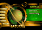
Interactive resource that allows us to explore the planets of the Solar System (surface, interior, satellites, etc.).
-

Weather and climate - The weather
EduBook Organización
- 3508 visitas
Predicting the weather Meteorologists collect data from weather stations and use it to make weather maps. They use these weather maps to predict the weather for the next few days. This is the weather…
-

-

-

Initial evaluation 5 - The Universe and our Solar System
EduBook Organización
- 1518 visitas
Are the following astral bodies inner planets, outer planets, dwarf planets or satellites: Mars Saturn Ceres Ganymede Neptune Leda Eris Venus
-

Answer. Aspects of the Solar System 03
EduBook Organización
- 1613 visitas
Among the planets of the Solar System, choose... ...which has the most satellites. ...which has the longest year. ...which has the longest day. ...which is the largest gaseous planet. ...which is the…
-

Final self-evaluation 8 - The Universe and our Solar System
EduBook Organización
- 1174 visitas
Identify each planet of the Solar System from its characteristic: It has the most satellites. It has the longest year. It has the longest day. It is the largest gaseous planet. It is the smallest rocky planet.
-

Think. The representation of the Earth
EduBook Organización
- 1 lo usan
- 2116 visitas
Think about how maps are made and answer: Why are satellites important tools for cartographers? What type of information do they provide? How do you think cartographers got this information before…
-

Bringing space down to earth!
EducaMadrid Organización
- 4053 visitas
Europe's space satellites play an indispensable role in the day-to-day functioning of our society. It influences on various activities; such as watching our favourite football matches or sending SMS'es…
-

Nature and society: harmony, crisis and impact
EduBook Organización
- 1 lo usan
- 7954 visitas
Over the last few decades, technology has advanced so much that we are now able to obtain detailed images of the Earth via satellites. This enables us to see the impact humans have made on the…
Te estamos redirigiendo a la ficha del libro...


